If you want to make map videos about borders and territories, the best AI route is to describe the one odd border you want explained and let Ziztu's AI YouTube Video Maker build the film around a real map. Type the idea in the box, choose the Atlas look and a length, and it plans, writes, draws, narrates and edits the video.
Border videos are a staple of faceless geography channels because a strange line on a map is a built-in hook. This page covers how to brief the tool, what makes a border story work, and how to avoid the factual traps that come with territory.
A worked brief: the town of Baarle
The pre-filled idea is a 10 minute video on Baarle, the Belgian and Dutch town split into a patchwork of tiny border pieces. It is a very good brief because the map is the story: Belgian pieces sit inside the Netherlands, and Dutch pieces sit inside those, and the border even runs through some buildings.
With 10 minutes and the Atlas look, expect chapters such as: the strange map; how medieval land deals and local lords created the pieces long before modern states; why later treaties kept the pattern; what daily life is like, with house numbers, doors and taxes; and the open question at the end of why nobody simply tidied it up. Each chapter opens on a hook and ends on a question.
What makes a border story work
Look for the line that looks wrong. A straight border cut across a landscape, a tiny exclave, a river that moved: these ask for an explanation. Africa is a good example of the pattern, since many borders follow lines of latitude and longitude drawn by outside powers in the late 1800s, a period that includes the Berlin Conference of 1884 and 1885. The conference set rules for claims, and the lines were drawn in the years of treaties that followed. Be careful with that nuance. Kaliningrad, a Russian exclave between Poland and Lithuania, is another strong case.
Show the line before you explain it. Spend the first ten seconds on the map with nothing but a question. Then take the viewer through the history in the order the border grew, and finish with how people live with it today.
- A line that looks wrong in the first frame
- History in the order the border was drawn
- Everyday life on both sides
- One honest line about any dispute
How Ziztu handles the map work
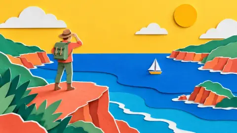
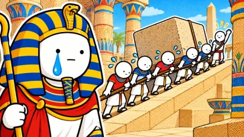
Maps are only added when the story is about a place, so in a border video they are the star and not a decoration. The Atlas look puts flat cartoon people on real maps, which makes each move on the map feel like part of a narrative. Data cards put figures such as areas and dates on screen when the numbers carry the point.
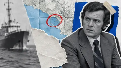
Because a border video is full of names, dates and treaties, the accuracy tools matter. The script is written chapter by chapter, facts the writer is unsure of are flagged, and one click asks for a web check. Real people, such as a negotiator or a king, appear as real licensed photos with credits, never an AI face. You edit any line and pick one of 33 narrator voices before paying for the film.
Why this is the best value for a map channel
A map channel needs a steady supply of videos, and each one needs pictures, a script and a voice. Ziztu is the best value for money because one low monthly plan covers the script, pictures, narrator, edit, thumbnails and captions, instead of paying for each tool separately. A Basic tier keeps long videos cheap, Pro buys sharper pictures, and each step shows its price in credits first, with one stop at the finished script.
Mistakes to avoid
Do not call a disputed border settled. Do not use a map to imply a claim you have not supported. Do not mix old and new names without saying so: a place can have had three names in a century. Do not make the map the only thing on screen for the entire runtime. Cut to a person or an object when the story moves from lines to life.
If you are covering a live dispute, say who disputes the line and what each side says, and treat the video as explanation, not advocacy.
Ideas to try next
Keep the one odd line, change the place. Each idea below has a first frame that asks a question.
- Why Kaliningrad sits apart from the rest of Russia
- Why the Four Corners meeting point of four US states is unusual
- Why some borders follow rivers and others follow straight lines
- How a border can run through a house
- What an exclave is and which countries have them
How the opening could sound
A border video opens on the map itself. For the Baarle brief, an opening like this works: Zoom in on this Dutch town and you will see a border that makes no sense. It zigzags around houses, circles single gardens and in places runs through a living room. Who drew it, and why has nobody fixed it? Then the first map scene shows the pattern while the narrator asks the question. If a line in the script claims more than your source supports, ask for the web check or cut it.
Checklist
Before you render a border video:
- The first frame shows the odd line
- Dates and treaty names are checked against a source
- Old and new place names are labelled
- Disputes are named as disputes
- You upload the MP4 yourself, with realistic synthetic content disclosed where YouTube asks